
Mapping & GIS Services
Headland delivers high-quality mapping and geospatial analysis to support planning, decision-making, and communication. We work with photogrammetry (3D mapping from aerial imagery), orthographic imagery, and LiDAR data to produce accurate, reliable spatial products.
Beyond data processing, we provide map design, visualization, and analysis tailored to your project. Whether you need 3D models from LiDAR or photogrammetry, georeferenced imagery, or clear, effective maps for planning and engagement - we ensure the outputs are both technically sound and easy to use.
Remote Sensing
& Analysis
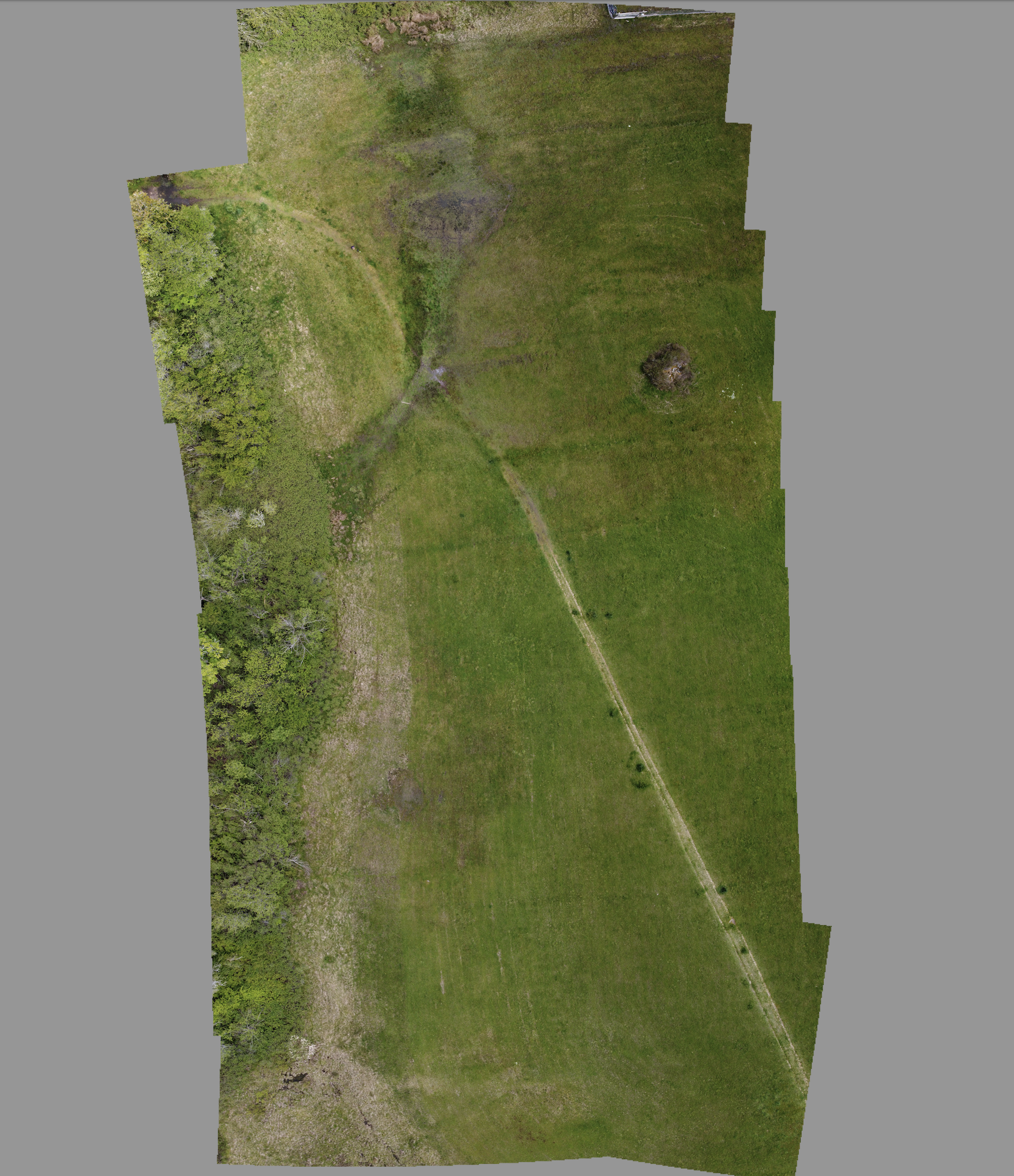
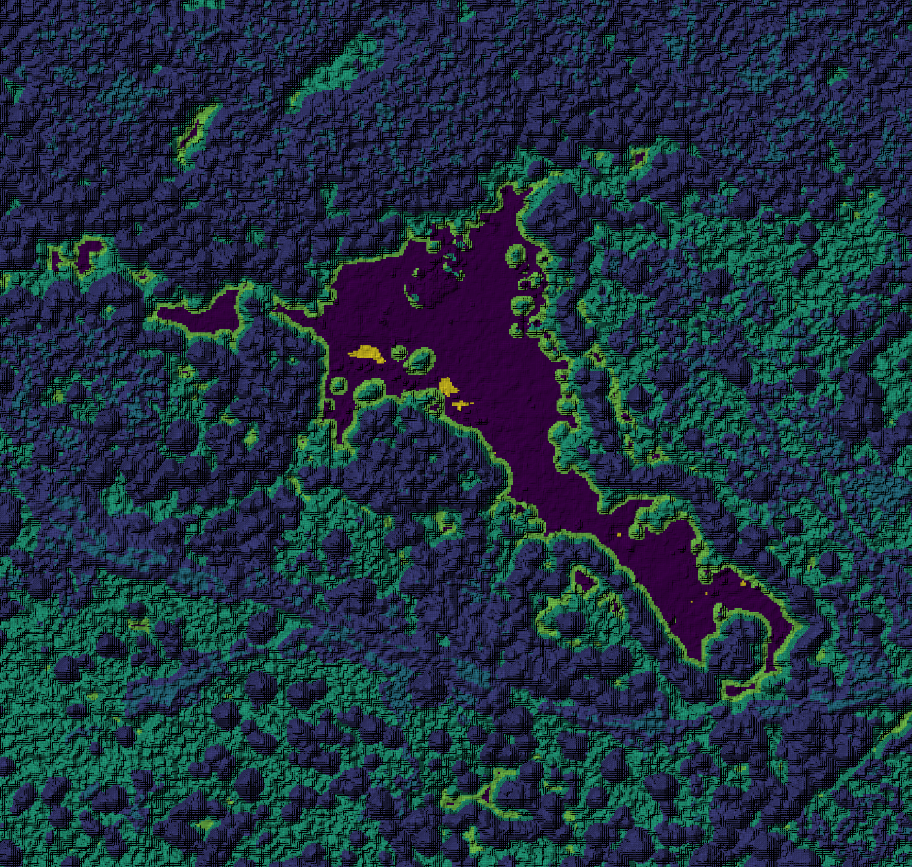
We turn remote sensing data into clear, actionable ecological insight. Using drone and satellite imagery, we produce orthomosaics, surface models, and a range of environmental metrics that help you better understand landscape conditions.
Our work includes vegetation and canopy analysis, wetland and land-use mapping, and change detection - supporting a deeper understanding of how environments are evolving over time.
Cartographic Services
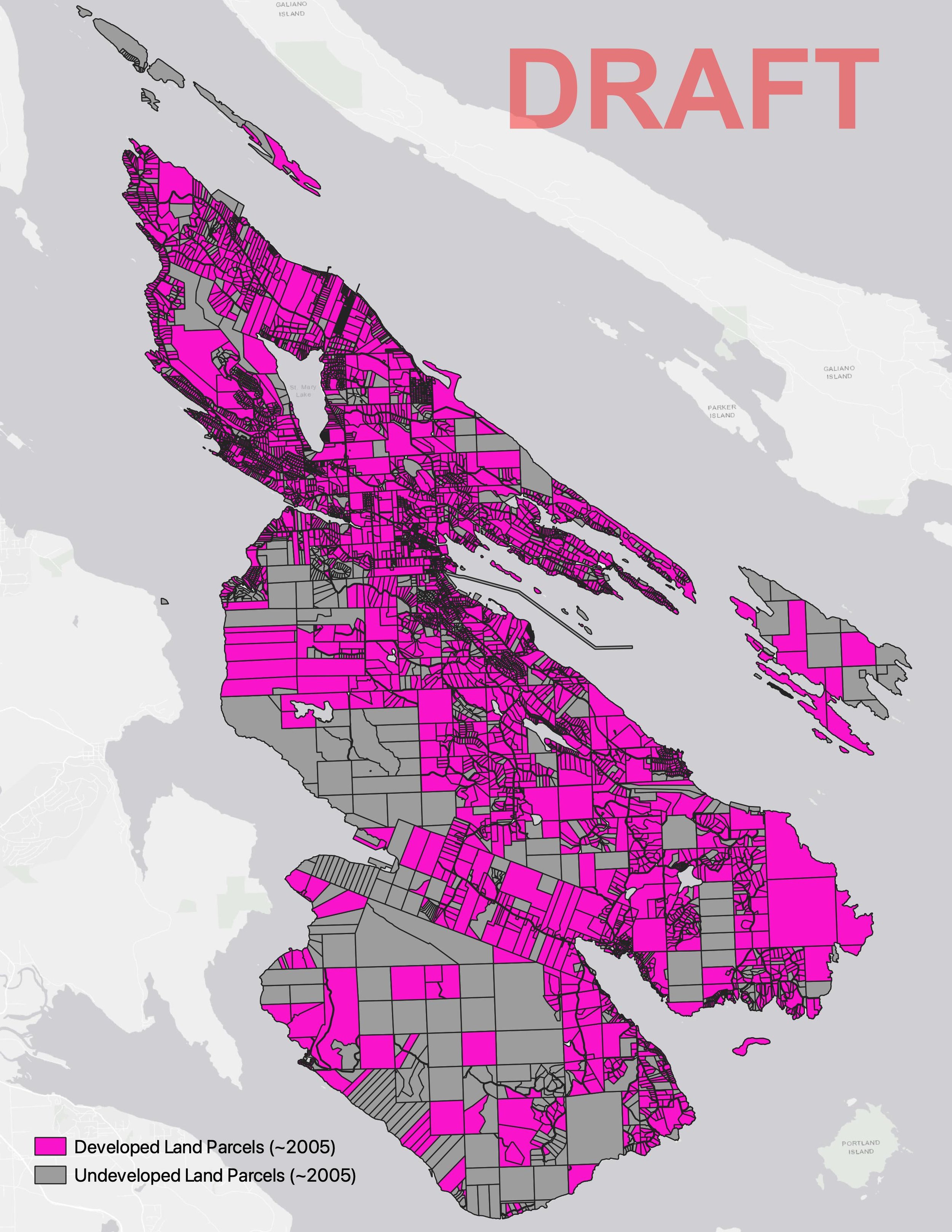
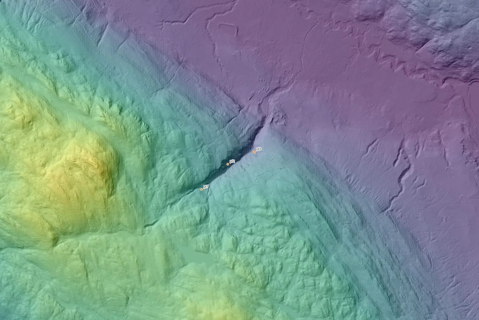
Our cartographic work aims to take complex data and create visually compelling and easy-to-read maps to show things like land use planning priorities, infrastructure, access locations, development considerations, environmental constraints, and community-defined values. We can incorporate information such as slope, soils, hydrology, hazards, and drone-based orthomosaics to produce maps that are both technically accurate but also exciting to engage with.
Clear, professional maps strengthen grant applications by demonstrating spatial need and project scope. They make community engagement more effective by presenting findings in a way that resonates with audiences. Whether you're supporting a land use planning process, preparing a funding proposal, or communicating results to your community, our maps can help make spatial information meaningful and accessible.
Data Collection, Management & Training
When your project requires on-the-ground data, we provide the tools, training, and support to collect it effectively. We work with ESRI and open-source platforms to design and implement field data collection workflows tailored to your needs.
From water quality sampling to species monitoring, we help you build reliable datasets that complement remote sensing and spatial analysis - creating a more complete picture of the systems you’re working with.
Pricing
Our pricing is tailored to the scope and needs of each project. We’re happy to start with a no-cost consultation to understand your goals and explore what’s possible.
From there, we provide a clear quote and outline of deliverables based on your timeline, priorities, and budget.
Ready to get started?
We’d be glad to connect and see if we’re the right fit for your project. Fill out the form below, and we’ll be in touch.